In February, I twice took a walk upon Pennard Hill, a paradise of undulating earth, combes, ridges, and springs, amidst fields lined by far-reaching hedges, carved through by ditches and holloways topped with veteran specimens of all kinds.
I parked Ron, my trusty 90s Fiesta, at the bottom of a deep holloway known as Scottles Lane. The word “scottle” is an archaic or provincial term, meaning to cut, tear, or carve something in an uneven way, the perfect name for a ragged holloway cut into the hillside.
To slightly spoil this romantic connotation, on 1800s OS maps the lane is called ‘Cottles’, which is more likely derived from a local surname. At the top of the hollow, a flow of water falls from a pipe into a brick basin, and runs all the way down the hollowside. It’s fed from the ditches of the surrounding fields so is definitely not for drinking, but it does make for a picturesque holloway with the sound of running water trickling in and out of perception and huge oaks, ash, and hazel coppices overarching the path.
Continuing on this lane, past the substation, is a gated left turn which leads along a lapsed hedge and down the hill to a modest holloway. Unnamed on maps, the way leads to Styklynch Farm, so might be well named after that, but there are many other features in its vicinity that might be suitable names for the hollow. I might call it Chestnut Hollow, for example, as standing on the bankside to the right is the largest sweet chestnut in the area, a notable 4-5 metre girth pollard.
The left side of the holloway drops away into a wooded combe which at this time of the year is not overgrown and quite accessible though very wet underfoot. This is the western portion of Pennard Wood, marked on Victorian OS maps dating to 1885.

 A partially distinct sprawl of creature paths, yet to be fully defined by spring’s boundaries is spread out through the trunks. It provides a vague course of safe passage through an intriguing arboreal maze of alder, larch, sweet chestnut, birch, oak, ash, sycamore, beech, wych elm, hazel, the odd elder and holly.
It’s a tree identifier’s dream, especially as the leaves are yet to arrive and for the most part the twigs are far out of reach. In this case we rely on bark patterns, growth habit, and the language or script of the tree written by its end branches silhouetted against the sky. In a crowded wood this can be very tricky. On my first visit, I didn’t even spot the presence of wych elm scattered quite abundantly throughout the wood, a fact I was glad to realise on my second visit.
The flora has all the scent and demeanour of an ancient wood (continuously wooded for over 400 years), with ferns and fungi sprouting from deep mulch, yet it’s difficult to get a firm grasp on the age of the trees. In some cases they appear to be young and without substantial girth, but in select cases their bases feature holes and hollows which might suggest trees of a greater age.
Substantial sweet chestnut and ash coppices show signs of harvesting for timber, multiple trunks of new growth have grown from previously single-stemmed trees. Many sycamores also sport multiple leaders, with extravagantly formed bases suggesting they may be on their second growth or else have sprung from the decaying trunk of another tree that has now completely disappeared. I also found an elm that had regrown from its previous fallen leader.
According to the maps, a wood has existed here since at least 1885, but only a handful of the trees currently growing could be dated to that time or before. The lack of veterans here, along with a host of timber tree species, suggests the woodland was heavily worked during the 19th and 20th centuries and what we see now is a far more recent replanting.
In terms of recent history, the birch trees provide a key clue here. They are veteran trees with 80+ cm girth and perhaps 50-70 years of age. As birch is a pioneer species, they grow on cleared land not in the understory, which suggests that some point since the 70s parts of this wood may have been felled and replanted, and that may have been the last time it was used commercially.
The presence of wych elm also provides a clue. No plantation intended for timber would have included elm after about 1970 and the arrival of Dutch elm disease may well have been an opportunity to fell the wood before the disease took hold. All these clues point toward Pennard Wood being a plantation on the site of a semi-natural ancient wood that has been heavily managed up until the mid-20th century and since been left to its own devices. Perhaps the owner has plans to harvest the wood again in the next decades, though no sign of management is currently evident.
Beneath the thick rug of the wood, the landscape’s floor shows tell-tale signs of older usage; means of human passage, enclosure boundaries, banks and substantial ditches. Subtle dips in the land indicate holloways that are now blunted by erosion and leaf matter. In some cases the ways are bare of trees, suggesting they were in recent use, perhaps the routes used when harvesting the woodland over the centuries, but they might also have been present in the landscape that predated the woodland.
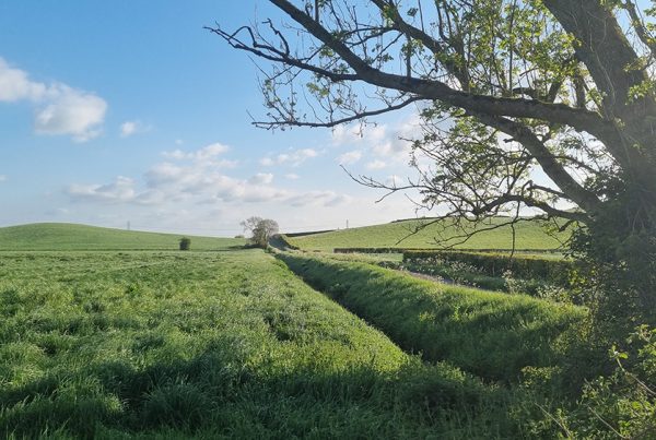
 If I am left to my fantasy, the large banks are ridgeways up onto the hill, and the sunken bowls with steep banks and the distinctive holloways like the one pictured above, are infrastructure associated with previous quarrying activity. Of course I have no archaeological evidence, but it is reported that marl was quarried from the lower banks of Pennard Hill during medieval times*, though the location is not specific.
History and usage aside, this secluded and magical little spot will only grow more majestic as spring moves in and the floor becomes carpeted with bluebells. There is little influence from humans here. Where paths exist they are trodden by deer and badger, and, besides the odd dog walker and intrepid explorers, I imagine not many people pass through this way.
It’s a relatively untouched paradise, a pocket of rainforest laden with ferns and fungi, where fallen trees are left to return to the soil, and dangerous branches left dangling in trees. Take care on a windy day as my first excursion was drawn to a close by a large ash branch falling a little too close for comfort.
Until next time, we walk To The Trees
MW
3/3/2026
* Marl Quarrying Reference
Map 1 – 1885
Also of interest: Map 2 – 1805
Also of interest: Map 2 – 1805
Pennard Wood Part 1
Pennard Wood Part 2
SPRING TREE WALK DATES
Equinox: Sun 22nd March
April: Sat 4th | Sun 12th | Sat 18th
May: Sat 2nd | Sun 10th | Sat 16th | Sun 24th
Meet at the gates to St John’s Church on Glastonbury High Street at 11am – £10pp.
RSVP: 07548 936 081
Private walks are available to book at a date and time to suit you – Book.
![]()
VISUAL DIARY
-

- Pennard Woods

-

- Pennard Woods – 1885
-

- Pennard Woods – Ash

-

- Pennard Woods – Turkey Tail

-

- Pennard Woods – Wych Elm

-

- Pennard Woods – Scarlete Elf Cup

-

- Pennard Woods – Sweet Chestnut

-

- Matt – Self Portrait

-

- Matt – Self Portrait

-

- Poplar, Mistletoe, Pilton

-

- Willow Hurdlees

-

- Pennard Woods – Sweet Chestnut

-

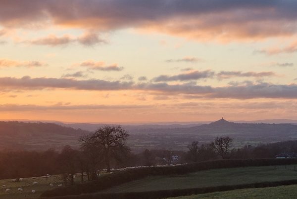
- Tor from Chalice Hill

-

- Beech – Stockhill Woods

-

- Ron with Beech

-

- 9 Barrows Bee he trees

-

- Willow Hurdles

-

- Ash Coppice

-

- Wych Elm Coppice

-

- Pennard Woods

-

- Pennard Woods – Ash

-

- Pennard Woods – Hollow

-

- Pennard Woods – Birch